
Support Hidden Compass
Our articles are crafted by humans (not generative AI). Support Team Human with a contribution!
It’s early morning on the Pacific Ocean. Our course is set westward as the bow of our small expedition ship breaks through the rolling swell, and the sun rises over the mountains of the mainland behind us. In the distance, through a milky marine layer, jagged rocks begin to appear, changing shape as the fog quickly shifts around them. To my left is a colleague who has worked extensively in these waters. She drops her gaze from her binoculars to turn and tell me that this place was first named Ennepah, meaning something along the lines of “mirage.” And there is no question why.
~~
As I start the engine of one of our Zodiacs and prepare to load guests for the first outing of our expedition, the sound of a foghorn ricochets off the sheer cliff faces that surround us. We have anchored in the Channel Islands of California. The unassuming chain is comprised of eight isolated and rocky islands lying only 20 miles off the coast of mainland Southern California. Despite their proximity to some of the country’s densest population centers, the islands remain seen but unseen, visible in the distance but often overlooked.
Ennepah is now better known as Anacapa Island, but the mirage persists. Nearest the mainland, the island is actually three — a group of precipitous islets whose peaks undulate from the water like a child’s drawing of a sea dragon. The rocks here are wave-battered and eroded, with little life to speak of. They give us an idea of what the islands might have looked like when tens of millions of years of tectonic forces and the convergence of two great plates succeeded in thrusting the sea bottom upward in a series of mountains that, when they finally broke the surface of the water, created the Channel Islands.
In the first minutes of our exploration from the water, a squadron of pelicans soars overhead before landing and settling on a craggy rock arch. Someone in my group begins to hum the Jurassic Park theme. It’s a fitting sentiment.
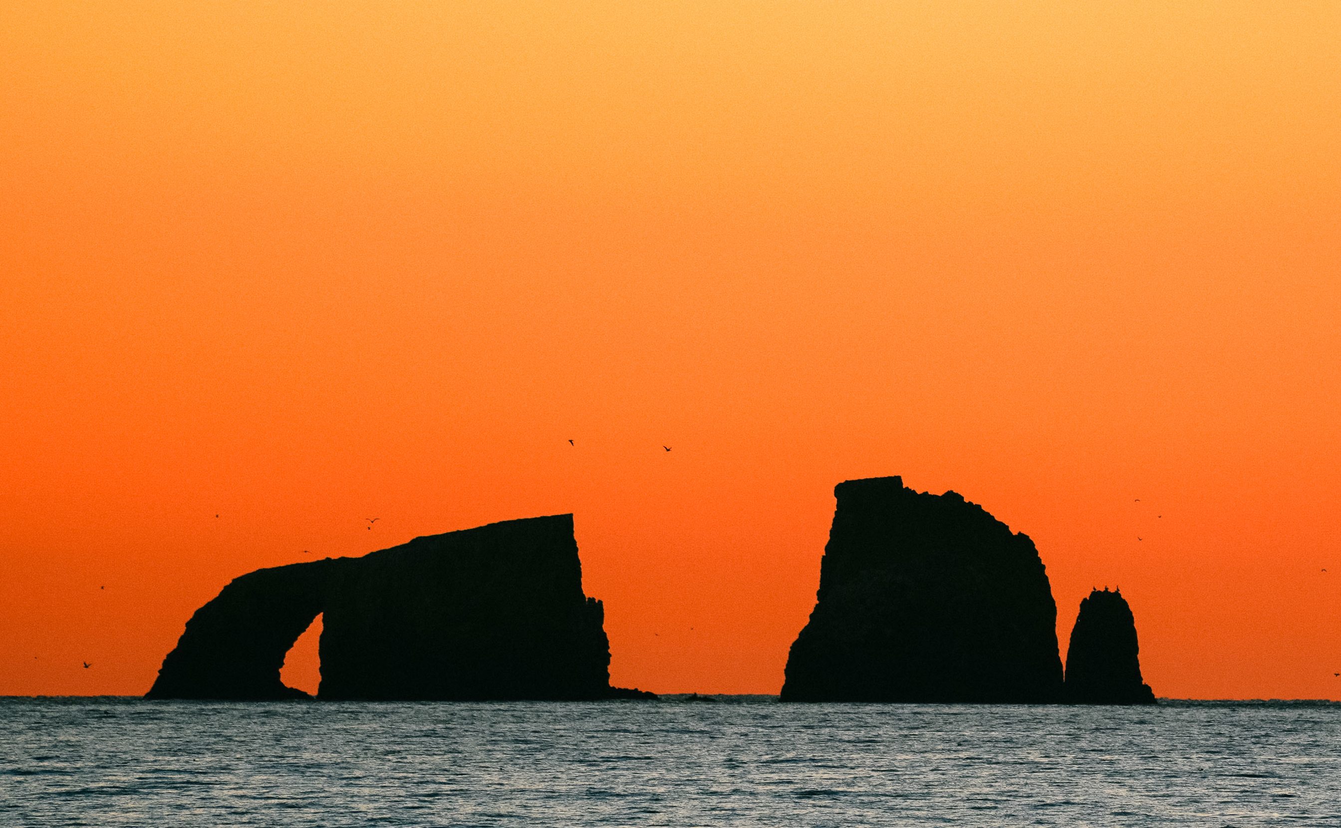
With their rugged cliffs, sea caves, and natural bridges, like the 40-foot-tall Arch Rock (pictured here), Anacapa Island’s three islets gives us a glimpse of what the Channel Islands might have looked like when they first emerged from the ocean. Photo: Alex Krowiak.
The visitors joining me are particularly adventurous and far-traveled, and for them, the islands can offer an underwhelming first impression. While the cliffs of Anacapa are rugged and dramatic, the land can be loudly desolate. There are no towering tropical rain forests like on the islands of the South Pacific, only succulents and shrubs clinging to the crags. Unlike in the Galapagos, there aren’t thousands of seals congregating and vocalizing, only the occasional individual resting on nearshore rocks.
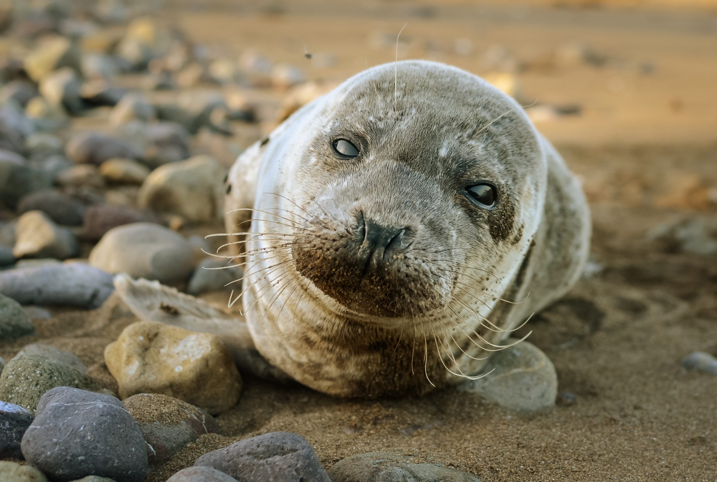
A harbor seal pup rests on the shore of Catalina Island in the Channel Island archipelago. Though northernmost San Miguel Island is home to several seal and sea lion rookeries, on Catalina and the southern Channel Islands, individual seals are a more common sight. Photo: Alex Krowiak.
The letdown is familiar. When I first came to the Channel Islands several years ago, I knew almost nothing about them. But after studying carnivorous plants in Iceland and kelp forests in South Africa and publishing a few scientific papers, I realized I wanted to reach a different audience. So, I moved to Santa Catalina Island, the most well-known isle in the archipelago, to teach marine science. I arrived in the middle of summer to a desiccated and seemingly barren land.
What have I done? I asked myself.
But I stayed — for three years. Now, as a photojournalist and expedition guide, these islands just might be my favorite place to work.
~~
As we approach our next stop, we see hillsides blanketed in wildflowers and shrubby evergreen growth. To some of my guests, this comes as a surprise.
“Any ideas where all this life came from?” I ask, as we scan the hillsides through our binoculars. Even from afar, Santa Cruz Island, the largest and arguably most biodiverse in the chain, sits in sharp contrast with Anacapa. The landscape here shows undoubtedly that, over millions of years, life began to make its way here and settle.
What was a blank canvas of inhospitable earth gradually transformed into a kaleidoscopic mosaic — a science textbook come alive.
In spite of the oceanic isolation, warm winds and swirling ocean currents brought the seed pods of diverse plant life. With their power of flight, sea birds and insects colonized the hillsides, and around the islands, productive waters created the conditions for towering kelp forests and the marine life that inhabits them.
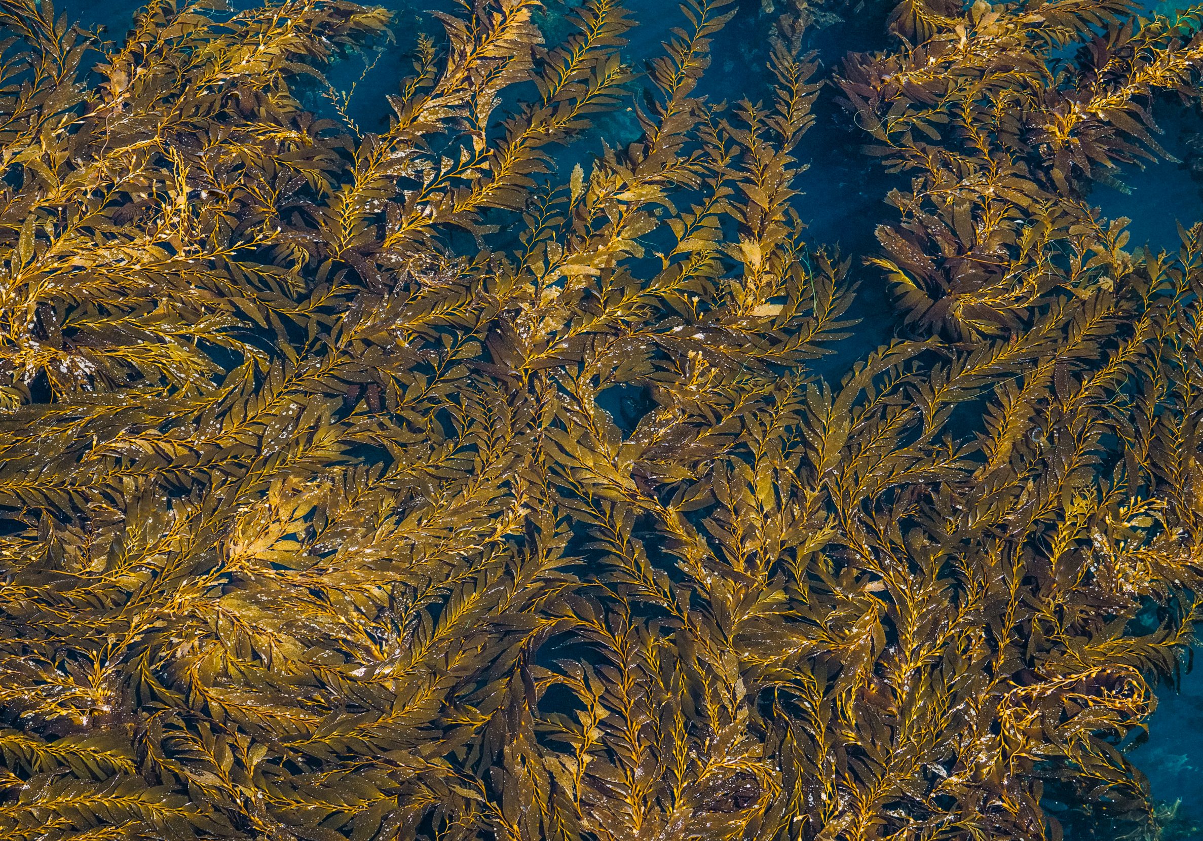
Kelp swirls on the ocean surface. Underwater, towering forests of the marine algae and seaweed support an abundance of life — more than 1,000 species of flora and fauna — by providing both food and protection. One third of the world’s kelp genera are represented in the kelp forests of the Channel Islands. Photo: Alex Krowiak.
What was a blank canvas of inhospitable earth gradually transformed into a kaleidoscopic mosaic — a science textbook come alive. The deep-diving double-crested cormorant (Phalacrocorax auritus) plunged into waters in which the vibrant orange Garibaldi damselfish (Hypsypops rubicundus) and the charismatic California sea lion (Zalophus californianus) swam. On land, the sinuous vines of wild cucumber (Marah macrocarpus) wrapped around the black sage (Salvia mellifera) that filled the air with a distinctive desert fragrance.
Over the course of thousands of years of isolation, through the forces of adaptation and evolution, many of these organisms have become uniquely of this place, differentiating into species that are found nowhere else in the world. To date, scientists have identified more than 145 species of endemic plants and animals that live only on this inconspicuous island chain. So distinct is this array, some people call the Channel Islands “the Galápagos of North America.”
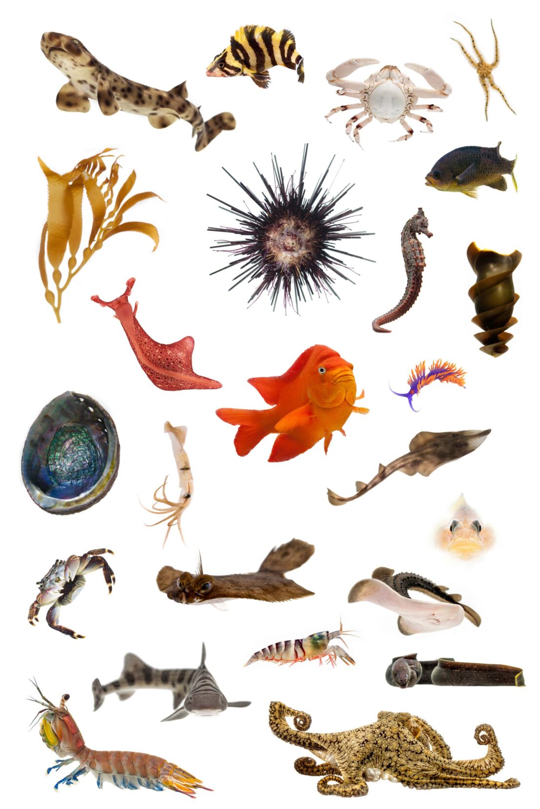
The biodiversity of the Channel Islands is one reason why some call it the Galápagos of North America. Species pictured above include: giant brown kelp, crowned urchin, California sea hare, mantis shrimp, leopard shark, and, at center, the vibrant Garibaldi damselfish — the state marine fish of California. Photo: Alex Krowiak.
Among those plants and animals is the endemic island fox — a descendant of the gray fox found on the mainland. Here on the archipelago, it speciated into six subspecies, and despite being among the smallest canids on the planet, for thousands of years the island fox was the largest animal to roam the hillsides of the Channel Islands. By the 1990s, however, they were nearly extinct.
~~
We’ve landed on Santa Rosa Island, and I lead a group along a ridgeline trail as we hike to our afternoon destination, a grove of rare Torrey pine trees. Once widespread, Torrey pines began to disappear as climatic conditions changed over millennia. Now, only two wild groves survive, one of which can be found here.
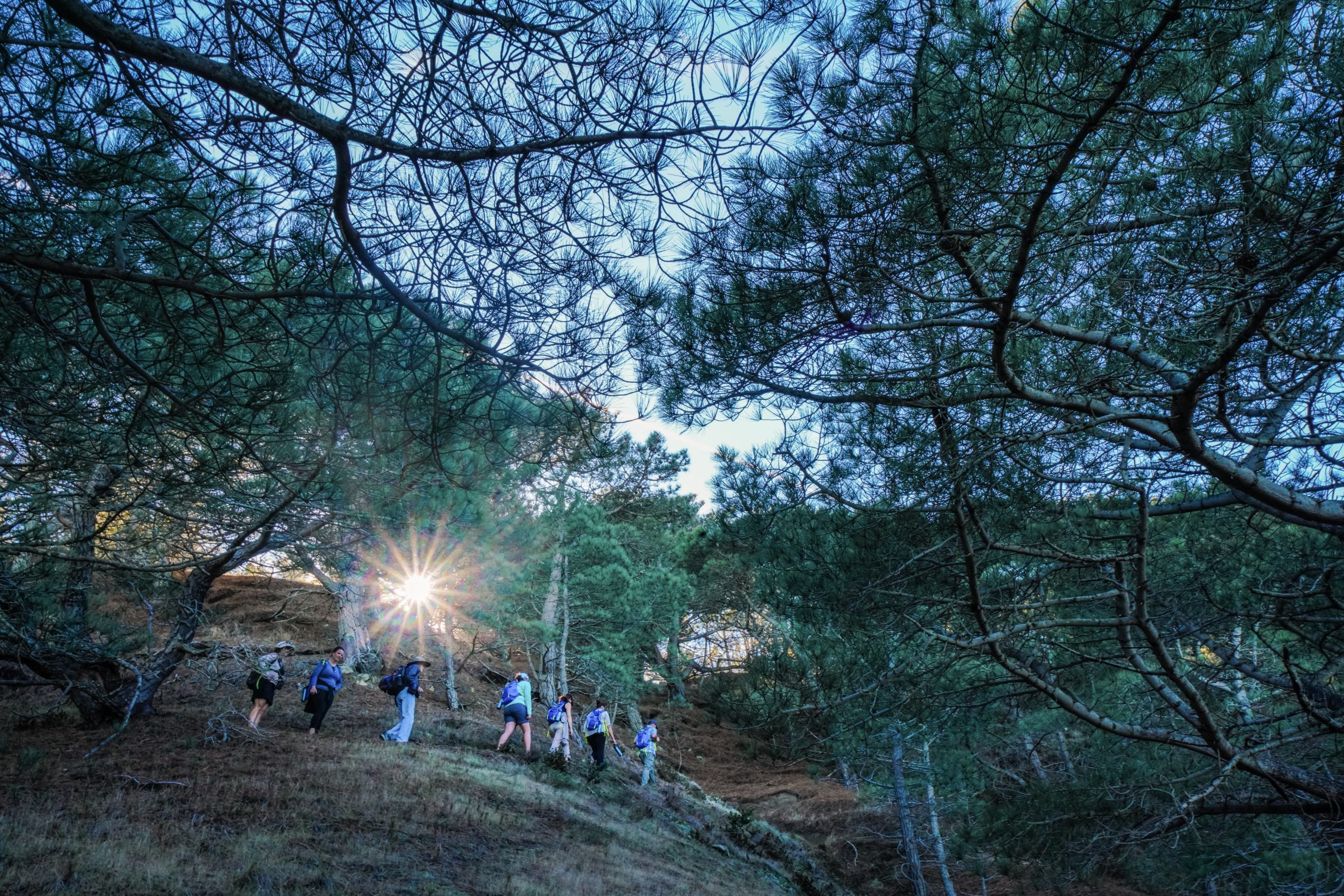
Hikers walk among a grove of Torrey pine trees on Santa Rosa Island. The island’s subspecies of Torrey pine is among the rarest pines in the world — “the last enduring members of a once widespread Pleistocene forest,” according to the National Park Service. Photo: Alex Krowiak.
To get the opportunity to stand beneath these living, woody fossils, we pass through a diverse landscape — one unique even among the other landings we’ve made. Rolling hillsides, whose tall grasses wave with the ocean, give way to lush canyons cutting through the island’s interior.
Along the coastline, the ancient layers of sandstone bluffs transport us back in time like the rings of a tree.
But there’s another story here — a human story.
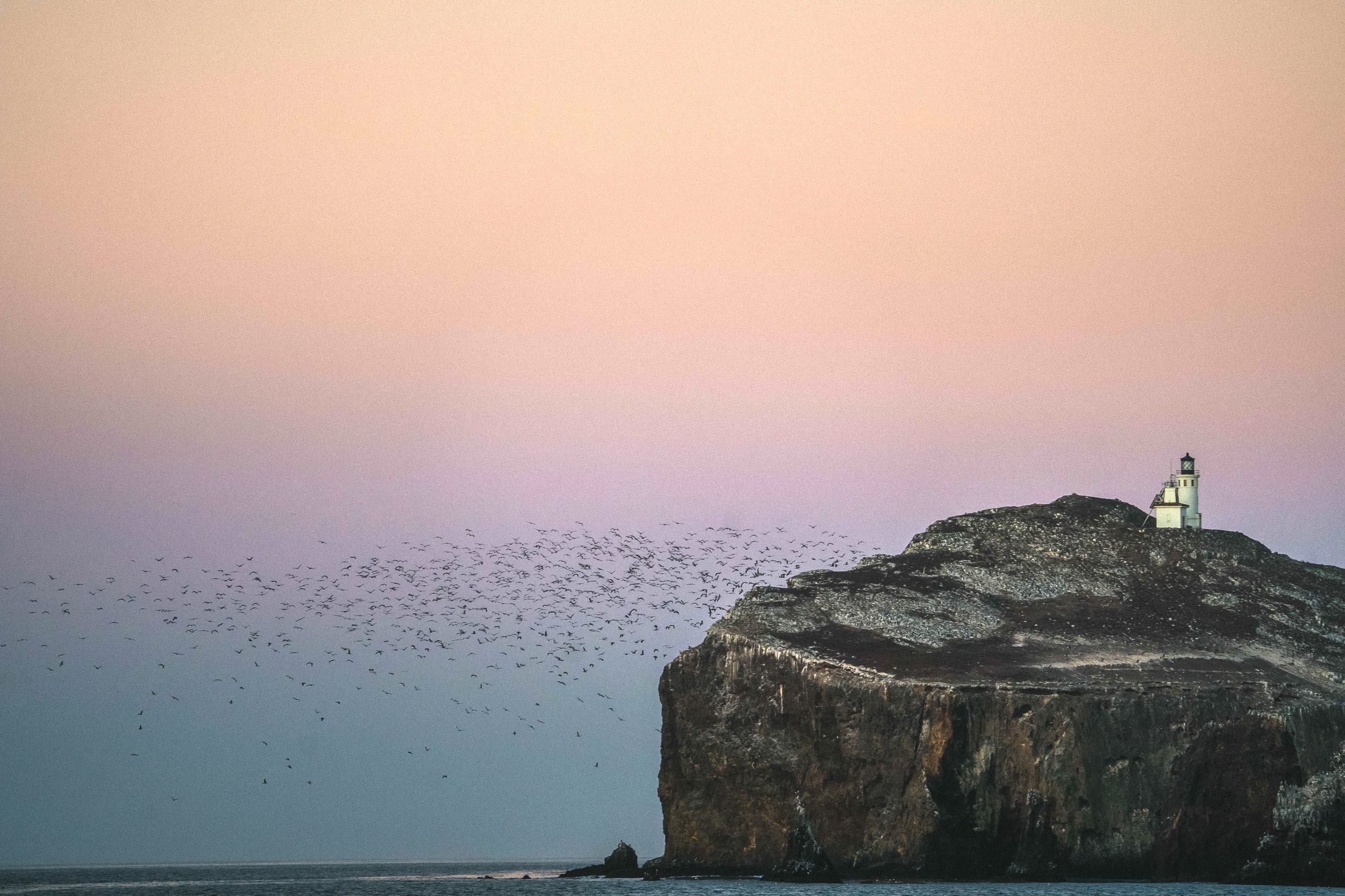
Following a series of shipwrecks in and continued marine traffic through the Santa Barbara Strait, the Anacapa Island Light Station was completed in 1932. Throughout the islands, reminders of the archipelago’s human history abound. Photo: Alex Krowiak.
At several points along the way, members of my group pause to point out and question the things that seem out of place — dilapidated ranch houses that sit abandoned in the valley below us, towering oil rigs that dot the horizon to our north, non-native plants that carpet hillsides entirely.
All relics, I tell them, from a long, long period of degradation.
Around us, I call attention to remnants of this period and the persisting signs of decimation. Eroded hillsides filled with non-native plant species such as sweet fennel and eucalyptus point back to the ranching era of the late 19th century, when expanding operations produced as many as 7,000 cattle per year and ushered in an age of environmental ruin. Suddenly, thousands of hoofed cattle, sheep, rams, and horses roamed free, bulldozing the dry, brittle soil and uprooting the fragile native flora. To provide food for their livestock, the ranchers introduced invasive grasses and plants, which quickly overran drought-adapted native species such as the island live-forever.
Looking back toward the mainland, we see signs of the industrial explosion of the 20th century that seeped to the shores of the islands. Among the silhouetted smokestacks lies what used to be the country’s largest producer of DDT, a pesticide that persisted in the marine food chain and built up to lethal levels in top predators like bald eagles. Throughout the 1950s and ’60s, thousands of tons of the chemical were dumped directly into the waters off Southern California and the Channel Islands. The result was a devastating trophic cascade — fish became toxic, the bald eagles that ate the fish disappeared, golden eagles filled the newly empty niche and began preying on land mammals, and the endemic island fox was hunted to near extinction.
In a final dramatic blow to the area’s pristine seas, January 1969 brought the largest oil spill in California’s history — then the largest in the nation’s as well — just miles from the island chain. A well blowout released millions of gallons of crude oil into the ocean. It took a week and a half to cap the well, but the blowout had been so powerful it ruptured the seabed, and oil and gas continued to flow from the fissures for the rest of the year. All told, as much as 4.2 million gallons of crude ultimately gushed into the sea and floated to the surface, where it silenced the crashing waves, painted the rocky beaches black, and coated marine life for miles around. Driven by the lure of resources, decades of economic exploitation and ecological invasion collided in a perfect storm. It transformed the landscape in front of us.
~~
On the third day of our trip, I glance at the list of species sightings we keep on board. The check marks in the columns next to “bald eagle” and “humpback whale” are symbols of a new chapter in the story of the Channel Islands. A chapter of conservation and collaboration between multiple agencies and organizations, including the National Park Service, the Nature Conservancy, the Institute for Wildlife Studies, and the National Oceanic and Atmospheric Administration.
Roughly half the national park lies below the waves. Throughout the Channel Islands, 241 nautical square miles have been designated marine protected areas, where restrictions limit harmful activities and create a refuge for diverse aquatic life. On land, researchers are actively removing non-native plants and reintroducing natives such as the live-forever and goldenbush in a wave of reclamation that is slowly spreading across the islands. And a keystone project has focused on the island fox — that four-pound poster child for the islands.
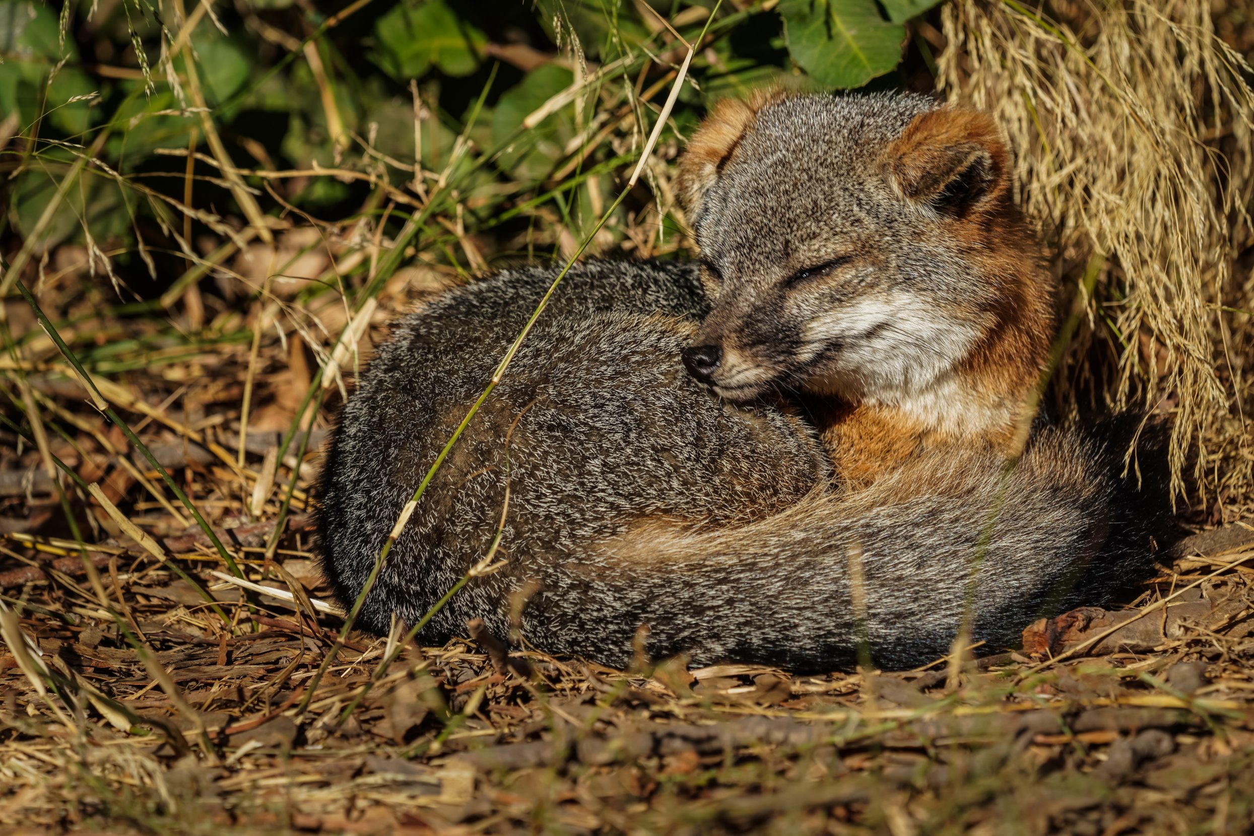
Descendant from the mainland gray fox, the endemic island fox went from being the largest animal to roam the Channel Islands to nearly extinct in a matter of decades. Photo: Alex Krowiak.
The island fox’s history and survival were deeply intertwined with and dependent on bald eagles, which feed primarily on marine protein like fish and carrion, but also exclude land predators, like the golden eagle, through intense territorialism. So, when DDT seeped into the food chain and the number of bald eagles plummeted, fox-hungry golden eagles took their place. The result was the decimation of island fox populations. Certain populations tumbled from some 2,000 individuals to just 15 — a staggering 99% decline.
Scientists spent years untangling the complex web that had left the island fox on the brink of extinction. But untangling it was only part of the battle. Restoring balance required the reintroduction of bald eagles, the removal of golden eagles, the eradication of additional food sources like wild boar, and the repopulation of what few foxes remained through captive breeding programs.
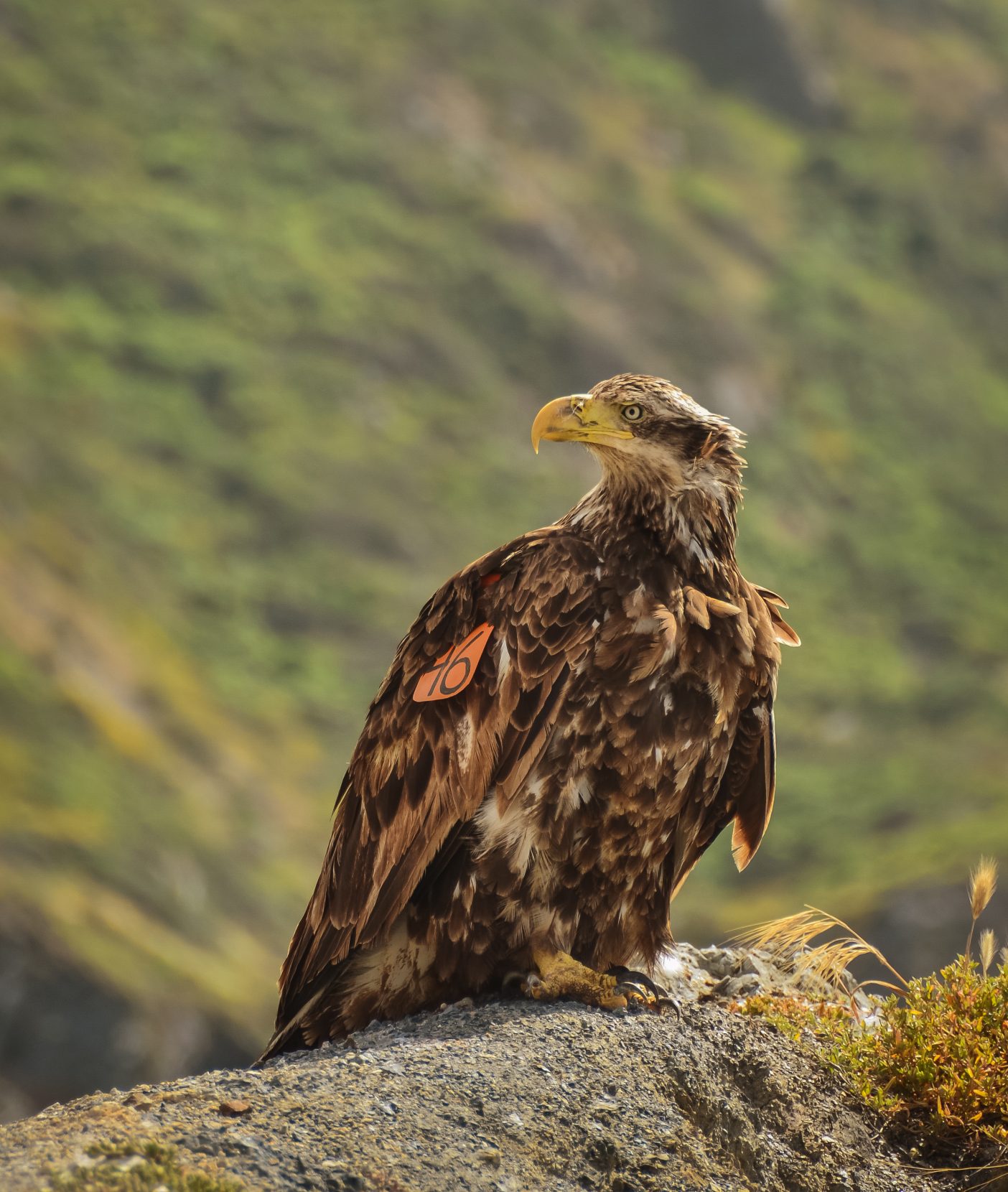
A juvenile bald eagle perches on a rock. As it matures, it will take on the more recognizable coloring of an adult. The loss of this iconic raptor turned out to be a key factor in the conservation story of the island fox. Photo: Alex Krowiak.
It took 25 years, $21 million — from donors, agencies, and DDT mitigation funds — and the work of hundreds. But in 2016, the foxes were taken off the endangered species list. It is still the quickest recovery of any animal ever to be listed.
~~
To some, this is the story of the Channel Islands — a story of recovery and renewal. But to many others, that story is oversimplified and neglectful.
There’s another translation of Ennepah — deception. As it turns out, the human narrative here runs much deeper than ranches and conservationists, and the landscape is not the only thing in need of revival.
“I didn’t anticipate that we would find what we did or that it would lead to all of these other discoveries,” says Dr. John Johnson, curator of anthropology at the Santa Barbara Museum of Natural History and an expert in California archaeology and ethnohistory. He’s referring to one of the most stunning archaeological finds of the 20th century.
In 1959, a fragment of a femur was unearthed on Santa Rosa Island. Named after the sandstone canyon in which the bone fragment was discovered, Arlington Springs Man was discovered by Phil Orr and studied further by Johnson and his colleagues. Bone protein and radiocarbon analysis dated the remains to some 13,000 years ago — to the late Pleistocene when sea levels were lower, and the four northern Channel Islands were still one.
These are the earliest dated human remains in North America. They’re also the earliest conclusively dated human remains in the Americas as a whole. They prove that after the seeds and the birds and the small mammals that roamed the islands, the next wave of life to arrive on the archipelago — human life — arrived 4,000 years earlier than we ever imagined. And still, the human story here is richer.
Bone protein and radiocarbon analysis dated the remains to some 13,000 years ago… These are the earliest dated human remains in North America.
“We believe we were here longer than that, that we were created on the islands,” Julie Tumamait-Stenslie tells me over the phone from her home in Ojai, California — just miles from the islands. Tumamait-Stenslie is the tribal chair of the Barbareño/Ventureño Band of Mission Indians. She is a tribal elder, singer, and storyteller whose lineage traces back to the Indigenous inhabitants of the Channel Islands — the Chumash. For years, she has worked to research and share aspects of her ancestral culture that were nearly lost: the language, the stories, the knowledge. On this day, she tells me of their origin.
“We don’t have us coming from a land bridge. The only bridge that we have is the … creation story that has us coming from the island.” She’s referring to the Rainbow Bridge. Passed through generations by oral tradition, the story tells of the creation of the Chumash on Limuw (what we now know as Santa Cruz Island). There, they grew from the land and traveled over a rainbow to spread across the mainland.
My conversation with Tumamait-Stenslie emphasizes for me how deeply the Chumash’s story is entwined with the islands.
The Chumash built tomols, plank canoes from driftwood, and sealed them with the natural tar that still trickles from fissures miles below the ocean surface. In these vessels, they braved the tumultuous conditions separating the islands from the mainland. Temporary fishing camps became dozens of permanent settlements, home to hundreds. The sea and land offered a bounty that allowed the Chumash to thrive in the seemingly sparse chaparral landscape: shellfish like abalone from the shallows, large sport fish like tuna from the open ocean, myriad berries from the valleys and canyons. The development of an early shell-bead currency (Chumash is loosely derived from “makers of shell-bead money”) allowed them to establish trade routes that stretched as far north as present-day Washington state and as far east as the Rockies.
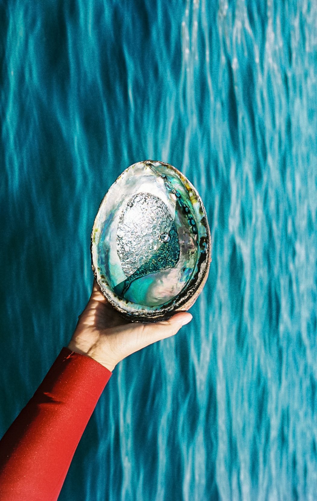
The iridescent colors of an abalone shell shine against the backdrop of the ocean. Indigenous to the Channel Islands, the Chumash lived off the land and sea, hunting and gathering berries and other plants on the islands, and fishing and harvesting abalone and shellfish. Certain shells also became part of an early currency that allowed the Chumash to develop far-reaching trade routes. Photo: Alex Krowiak.
Chumash history follows a similar trajectory as the ecological story of the islands — to a point.
Before the ranchers arrived on the Channel Islands, the Spanish came. Like in so many other places, the European settlers brought viral and bacterial diseases to which the Indigenous communities had no immunity. The forcible removal of the Chumash to missions on the mainland followed. Soon, this first wave of early Spanish explorers and Aleut otter hunters gave way to modern Westerners who brought their own ideas of exploitation.
Centuries of balance were disrupted in decades.
But while the ecology of the islands has seen a resurgence, the restoration of Chumash history has been overlooked.
Along the coastline, the ancient layers of sandstone bluffs transport us back in time like the rings of a tree. But there’s another story here — a human story.
“What’s your hope for the future of the islands during this era of conservation? And for the role of the Chumash?” I ask Tumamait-Stenslie, trying to understand what a truly successful recovery of the Channel Islands might entail.
She hesitates before telling me the story of her first trip to the islands. “I was invited on a trip to Santa Cruz for an elder’s birthday in 1990,” she says. “Three different families came to celebrate, and at one point we looked around and realized that it was the most Chumash on the island in 150 years. And we had to ask: Why aren’t we out here?”
For Tumamait-Stenslie and the group out there that day, the powerful moment highlighted the reciprocity and the accessibility that has been lacking in many efforts to restore the islands. It underscored the need for future conservation work to include the Chumash more directly.
Because to fully restore these islands requires reviving a connection — not only between the Chumash and their ancestral home, but also between what we think we know and the realities of history.
Tumamait-Stenslie speaks of the need for cultural centers on each island and of the possibility that lies in opening the door for the Chumash “to go out and explore our home anytime we want … to bring families who are financially strapped, working hand to mouth.”
“I think,” she says, “we should be allowed that little bit of reciprocity.”
~~
The last, long rays of the sun dip below a boundless horizon as we round the corner of San Miguel Island, the northernmost island in the chain, and set our course back toward the mainland. From this point, if I were to travel in a straight line to the west, I would not touch any landmass until Japan. Looking to the east, I view the line of islands and the points at which we made landfall. I see disparate islands with patterns of history that reveal an undercurrent of resilience and the potential for abundance. It’s easy to look out and see barren rocks, but the barrenness is only on the surface. Ennepah. The truth is much deeper.
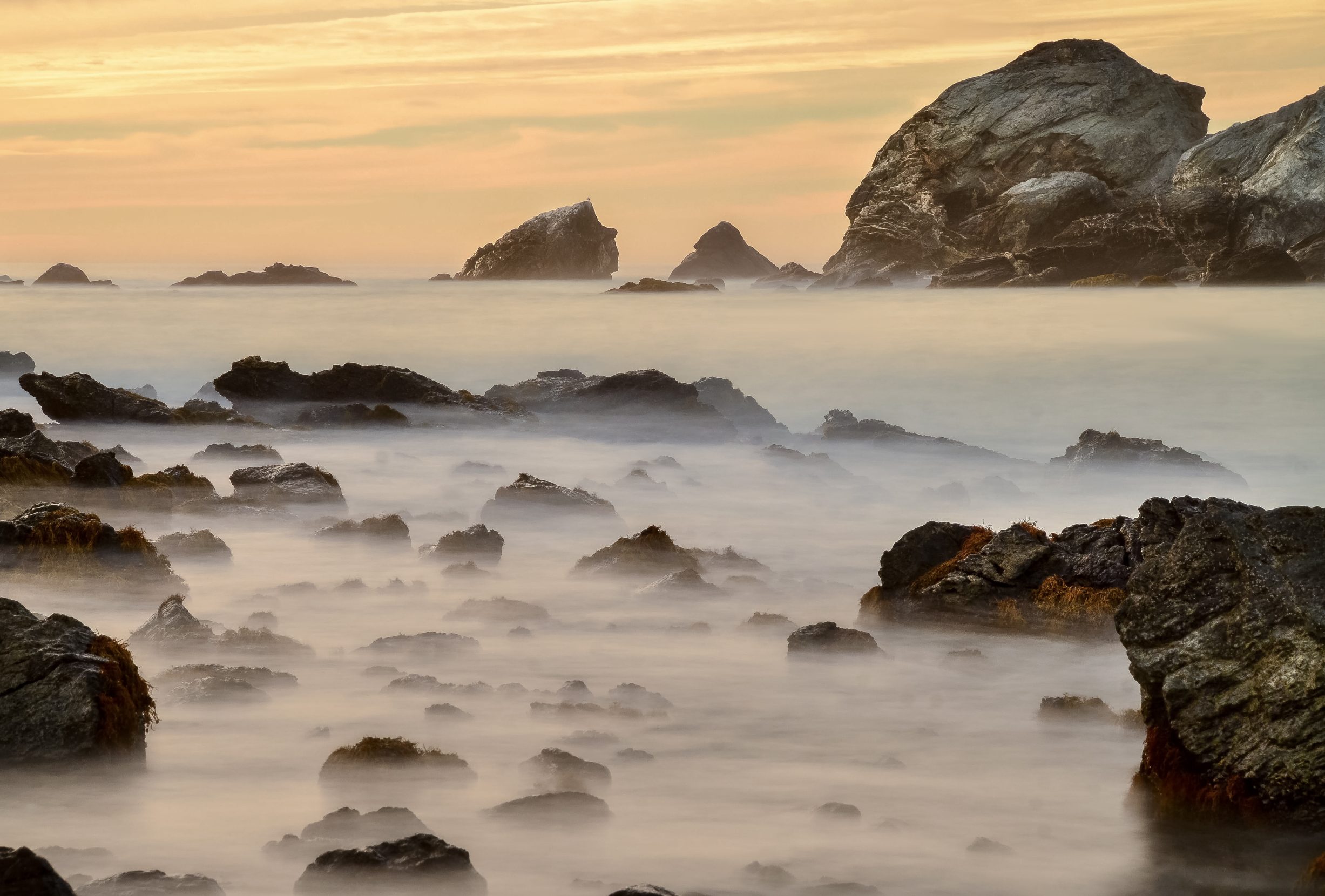
The most important stories often require us to look below the surface. Photo: Alex Krowiak.
Alex Krowiak
Alex Krowiak is a San Diego–based photojournalist and expedition guide working to tell stories of people, nature, and the changing relationship between the two.